Local areas
This online exhibition explores the diverse localities within the Municipality of Woollahra, each contributing its own unique character and rich history to the area’s cultural heritage.
Access via the Woollahra Libraries Digital Archive
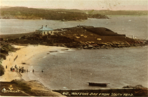
The South Head area, including Watsons Bay and Camp Cove, was originally the traditional land of the Birrabirragal people and played a crucial role in early European settlement. Recognized for its natural beauty, this area was designated a Heritage Conservation Area by Woollahra Council in 1995. A commemorative plaque at Cliff Street, Camp Cove, installed in 2008, marks key historical events in this locality.
The exhibition also highlights the preservation of Vaucluse harbour foreshore land for public use, thanks to the early 20th-century efforts of William Notting and the Harbour Foreshores Vigilance Committee. Their work ensured the protection of these scenic areas for future generations.
Visit the Woollahra Libraries Digital Archive to discover the unique contributions each area has made to Woollahra’s vibrant heritage.