The South Head area, including Watsons Bay and Camp Cove, once the traditional land of the Birrabirragal, has close ties also to the earliest days of European settlement. The locality has long been recognised as a place of outstanding natural beauty at the gateway to Sydney Harbour. The historical significance of this area was acknowledged by Woollahra Council in 1995 and gazetted as a Heritage Conservation Area.
In 2008 a commemorative plaque was installed at Cliff Street, Camp Cove, featuring a timeline of significant events in the history of the Camp Cove locality. Further information on the history of the South Head area has been complied below from the collection at the Local History Centre.
The Triassic period
220 million years ago, Hawkesbury River sandstone forms from accumulated layers of sediment, bedded at the delta of a wide, swiftly flowing river. The cliffs of the South Head consist of horizontal bedding layers of this sandstone, made up of quartz material carried from mountains of an earlier geological age located to the south-west of present-day Sydney. The quartz, bound together with clay and other ‘cementing’ materials, forms a resistant mass. Good examples of this ‘bedding’ formation can be seen in the cliff face at Cliff Street, Watsons Bay, opposite the Short Street intersection.[1]
The Jurassic period
160 million years ago, volcanic activity subjects the sandstone coastline to explosive pressures, the ultimate results of which may be seen today in various ‘Chines’ or chasms - such as the spectacular 2 metre-wide cleft in the South Head cliff-line known as Jacobs Ladder. Immense heat and pressure is generated, the force of which parts the sandstone strata along its natural joint lines, creating a fissure which is then filled by molten igneous material – largely basalt. Subsequently, this volcanic ‘infill’ (dyke) has eroded at a faster rate than its sandstone surrounds, leaving dramatic clefts in the cliff face.[2]
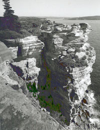
Jacobs Ladder from the south, 2000.
Photograph Woollahra History and Heritage Society.
The Pleistocene period
1 million years ago, an ice-age river, flowing 60 - 85 metres below the present sea-level, cuts through the uplifted coastal sandstone to bedrock.[3] Watercourses feeding the river cut deep valleys, subsequently filled by sand and mud, forming in their wake the beginnings of beaches and lagoons.[4]
Recent Geological history
130,000 years ago, inter-glacial warming causes the sea-level to rise some 6 metres above present levels. The South Head region becomes an island, separated by water from higher land to the west. Rock platforms are created around the harbour shoreline and ocean cliff-frontage from wave action during this period.[5]
20,000 years ago, during the last ice-age period, Port Jackson, now inhabited by early indigenous peoples, is an arid and rocky valley incised by freshwater streams.
8,000 years ago, the sea rises to its present level, and beaches and lagoons take on their present natural forms prior to European engineering intervention such as the piping of natural watercourses through storm-water systems. The land encompassed by the South Head region supports communities of Eora-speaking peoples of the Dharug language group. At the time of European settlement the Birrabirragal were based along the harbour shoreline of Vaucluse and Watsons Bay. Evidence of this early occupation remains today in the form of rock carvings and shell middens.[6]
- Crosson, R B “Sandstone and Woollahra” WHHS Briefs, No 23, Syd., WHHS, 1990.
- Crosson, R B “Physical history of Woollahra” WHHS Briefs, No 19, Syd., WHHS, 1990.
- Crosson, R B “The ‘ice-age’ river and Woollahra” WHHS Briefs, No 21, Syd., WHHS, 1990.
- Crosson, R B “The course that water took in Woollahra” WHHS Briefs, No 20, Syd., WHHS, 1990.
- Crosson, R B “Physical history of Woollahra” WHHS Briefs, No 19, Syd., WHHS, 1990.
- Martin, Megan “Thematic History of Watsons Bay”, Watsons Bay Heritage Conservation Study Syd, WMC 1997 pp. 15-16.
European settlement –1788 -
“We… had the satisfaction of finding the finest harbour in the world…”
Captain Arthur Phillip, first governor of New South Wales, in a letter to Lord Sydney, May 1788.[1]
1780s
The importance of the South Head district in the earliest years of European settlement is defined by its position at the gateway to the harbour and its role as a navigational landmark.
1788
- Captain Arthur Phillip, with a party of officers and marines, lands in Port Jackson on 21 January at an unnamed place which, in original accounts, is consistent with the beachfront at Camp Cove. The group made a meal at this place, boiling meat over a campfire on the beach. This occasion marks the first landing of members of the First Fleet within Port Jackson, and the first known European landing in Sydney Harbour.
- Camp Cove – the first landing place(PDF, 28KB) for more information.
A bicentennial commemoration at Camp Cove, 21 January 1988, of Phillip's landing at Port Jackson.
Photograph Woollahra History and Heritage Society.
- The name ‘Camp Cove’ is charted on Hunter’s survey of the harbour, work on which began on 28 January 1788 and was published in Phillip’s Voyage the following year[2]. Hunter’s instructions for sailing into Port Jackson, also reproduced in Phillip’s Voyage, establish Camp Cove by name as a navigational mark on the advised route for inward-bound vessels[3].
1790s
The origins of a settlement are laid down in the South Head, Watsons Bay and Camp Cove area during this decade, and the first grant of land issued.
1790
- A decision is made in January to establish a Look Out Post at Outer South Head and a flagstaff to communicate with shipping. The Post was established by Captain John Hunter on 20 January, and some ten days after this Lieutenant William Bradley was placed in charge. The site of this first Post is marked today by the South Head Signal Station.
- South Head Signal Station(PDF, 250KB) for more information.
- Governor Phillip and Bennelong visit the Look-Out Post on 3 February. Bradley’s account of their visit includes reference to Bennelong throwing a spear for a length of some 98 yards against a strong wind.[4]
- The first signal from the flagstaff is displayed on 10 February for the armed tender Supply on her return from Norfolk Island.
- Midshipman Daniel Southwell is appointed superintendent of the Post, taking over from Bradley on 14 February.
- The first European settlement in the area is established at a location believed to lie within present-day Robertson Park,[5] when a stone-mason’s gang, bricklayers and carpenters were sent to South Head to build accommodation for the men of the Sirius based at the Look Out.[6] The post established a vegetable garden.
- A thirty-foot brick column on a stone base is erected near the Look Out flagstaff as a further navigational marker for ships in the second half of the year, the work beginning in August[7]. This marker, commonly known as Phillip’s Column, is referred to in a letter from Under Secretary King to Governor Phillip in January 1792 as a ‘measure extremely necessary and proper’[8].
1792
- The first resident pilot is appointed to the South Head area with the establishment in May of a fishery at South Head under the control of a settler by the name of Barton, whose additional duty was to ‘board all ships coming in to the harbour and pilot them to the settlement’. The fishery, at a time of extreme food shortage in the colony, was to be for the ‘exclusive use of the sick’.[9]
1793
- The arrival of the transport Bellona in the waters off Sydney on the evening of Tuesday, 15 January is met by a large bonfire burning at South Head – the first recorded use of a navigational light in Australia. Later an iron ‘fire basket’ mounted on a tripod was built for this purpose. The Bellona brought with it the first immigrant free settlers to the colony.
- The first land grant is issued in the area - a twenty-acre parcel at Watsons Bay and Camp Cove to Edward Laing on 28 May. Laing, who named the acreage Roddam Farm, was the assistant surgeon to the New South Wales Corp. The name Laing’s Point, which today applies to the originally-named ‘Green Point’ at the western end of Camp Cove, derives from this brief ownership. By December 1794 the grant had become the property of NSW Corps quartermaster Thomas Laycock.
- Town of Watsons Bay subdivision(PDF, 22KB) for more information.
- Phillip, Arthur/ Governor Phillip to Lord Sydney, Sydney Cove, New South Wales, May 15th 1788 reproduced in Historical records of New South Wales Vol.I, Part II.
- ‘Plan of Port Jackson, New South Wales …1788’/by Captain Hunter, reproduced in Phillip, Arthur& The Voyage of Governor Phillip to Botany Bay …. facsim. ed., Adel., Libraries Board of South Australia, 1968; first ed., Lond., John Stockdale, 1789 Plate 14, (facing) p. 142.
- Hunter op cit. pp. 142-143.
- Bradley, William A Voyage to New South Wales : the journal of Lieutenant William Bradley RN of HMS Sirius, 186-1792. facsim of the original manuscript. Syd., Ure Smith/Public Library of NSW, 1969, p. 187.
- Martin, Megan Op. cit p.27
- Collins, David An Account of the colony in New South Wales facsim. ed., Adel., Libraries Board of South Australia, 1971;first ed., Lond., T Cadell Jun & W Davies, 1798-1802 p. 113.
- Collins op.cit.p. 132.
- King, John Letter to Governor Phillip 10th January, 1792 reproduced in Historical records of New South Wales, facsim ed Syd., Lansdowne Slettery, 1978 ; first ed., Syd., Charles potter, Government printer, 1892. Vol 1, pt 2, p. 590.
- Collins op.cit. p. 210.
1800s
A maritime community begins to form, based at first on the embryonic pilot service.
1800
- Robert Watson, for whom Watsons Bay is later named, is listed in the settler’s muster book as a pilot, although official biographical accounts suggest he was not based at Watsons Bay until later in the decade.
1801
- Robert Watson is granted land at South Head by Governor King. Watson, a First Fleeter who had served on the voyage as quartermaster of the HMS Sirius, held a succession of maritime posts from 1805: boatswain of the dockyard, senior pilot, harbourmaster and the first superintendent of the Macquarie Light-tower.
1803
- Surgeon John Harris undertakes to clear a 15 foot wide track to the South Head for the sum of £100 and in so doing creates a rudimentary forerunner of Old South Head Road, for which work he later complained he had received only £20.[1]
1809
- The Sydney Gazette of 22 January reports the disruption of a “genteel pleasure party” at South Head by the rare phenomenon of globe lightning during a summer storm. The group was gathered under a fig tree on the waterfront when the explosion of an “immense ball of fire” against a nearby rock threw ten members of the party to the ground. A number suffered minor burns, while the hair of one young woman was set ablaze. The entire group, which included Surgeon John Harris, Mr Gregory Blaxland and Lieutenant Laycock, survived.
1810s
The construction of Australia’s first lighthouse creates a symbol with which the South Head is associated still, and the introduction of a rudimentary road creates an important new means of access from the main settlement at Sydney.
1811
- In February, Governor Macquarie takes a party of guests by boat to picnic at Watsons Bay, the gathering settling themselves where the native fig-tree spreads its foliage into an agreeable alcove, as the Sydney Gazette [2] wrote of this expedition, continuing, beneath its verdant canopy a cold collation was presented, and after a stay of nearly two hours at this beautiful romantic spot, the company returned to town.
- Old South Head Road is formed by the labour of 21 soldiers of the 73rd Regiment in ten weeks beginning on 25 March. The road follows the approximate route of the track earlier cleared under the supervision of Surgeon Harris to the Look Out post, site of the present-day South Head Signal Station. An obelisk commemorating this roadwork still stands near Robertson Park, between Clovelly Street and Marine Parade. It is believed to date from the 1830s, and may have been originally positioned near the Look Out Post to mark the extent of the 1811 roadwork. A rough link road continued down to the foreshore, and was not replaced by an improved roadway until 1854.
- The first documented use of the name ‘Watsons Bay’ appears in the Sydney Gazette[3] in April with reference to Macquarie’s picnic. The name is accepted to have derived from the service and residency of early settler Robert Watson, a former seaman of the First Fleet flagship Sirius, pilot, and later harbourmaster and first superintendent of the Macquarie Light-tower. Watson was appointed senior pilot by Macquarie soon after the Governor’s February visit to the area.
1814
- Soldier Patrick Humphreys, while on duty at the signal post, is verbally promised a land grant of 4 acres at Watsons Bay by Governor Macquarie. These details are contained in a letter written in 1828 to Governor Darling by Humphreys requesting authentication, but formal title was not granted until 1835. Part of this grant was sold by Humphrey’s son in 1868 and 1877 respectively, and some was resumed for public recreation opposite the new baths in 1906, eventually becoming the site of a dressing pavilion known today as The Tea-rooms. However the residue of the land remained in the hands of the Humphreys family for well over a century after Macquarie’s original promise.
1816
- Construction of the first Macquarie light-tower begins in July (on the site of the present 1880s replica – one of the highest points on the South Head ridge) under the supervision of convict architect Francis Greenway. The structure is a circular sandstone tower with accommodation wings, built with stone quarried on site. Replaced by present structure in 1883.
- Macquarie light-tower(PDF, 134KB) for more information.
1817
- Structural work on the Macquarie light-tower is completed in November, and Greenway is presented in December with a conditional pardon by Governor Macquarie for his work on the building.
1818
- The Macquarie light-tower becomes operational and the first lighthouse-keeper, Robert Watson, is appointed in November, requesting a temporary leave of absence from his position on account of ill-health eleven months later.
1819
- Death of Robert Watson, for whom Watsons Bay is named, in The Rocks, on 1 November.
- Jervis, James A History of Woollahra., Syd., WMC, 1960 p. 74.
- Sydney Gazette 20.4.1811 p. 2.
- Sydney Gazette 20.4.1811 p. 2.
1820s
The strategic importance of the district is acknowledged in a new plan – not implemented for fifty years – to create a first line of defence for the colony at the entrance to the harbour.
1820
- A reconstruction of the 1811 road to South Head is undertaken by Major Druitt, a report of the project published in the Sydney Gazette on 15.1.1820.
- Commissioner Bigge, in correspondence with Francis Greenway in February, includes a battery at South Head amongst a list of appropriate building projects for the settlement.
- Major James Taylor, sent to assist Commissioner Bigge in his investigation into the affairs of the colony, advocates in his report of September the siting of batteries on both Inner North and Inner South Heads, supported by guns at Georges Head.
1830s
As recognition of the military importance of the district increases, the first substantial houses are built, and the first attempt made to sell land for suburban development.
1831
- New South Head Road is surveyed by Major Thomas Mitchell and built over the ensuing decade, becoming like its predecessor a scenic drive for the carriage classes. The new road meets the old near the Macquarie Light-tower.
1832
- A code of signal flags is established in order that messages might be sent from the South Head flagstaff via relay stations at Observatory Hill, Gladesville and Dundas to the governor’s residence at Parramatta. This system was later replaced by semaphore.
1833
- Compulsory use of pilotage is enacted, enforcing all ships entering the harbour to employ a licenced pilot. A number of pilots from the South Head region were licenced under the new regulations. Jobs were sought on a competitive basis, and the pilots provided their own crew and boats.
1834
- Grants earlier promised to pilots Thomas Watson and Richard Siddins are formalised, the Watson grant becoming the site of the house later named Clovelly and the Siddins grant the site of a house later named Zandvliet and today known as Dunbar House. Both these houses, built during the 1830s, were expanded and ‘gentrified’ by subsequent owners to conform to the style of the ‘marine villa’. Land associated with these grants now combines to form Robertson Park.
- Robertson Park(PDF, 97KB) for more information.
1835
- Repairs carried out to the Macquarie Light-tower at a cost of over £350, the substantial sum evidencing the importance placed on the light-tower by the colonial government. .
1836
- The ‘Bota Fogo’ estate, the first subdivision of land in the district, is offered for sale at public auction in March - despite that fact that the vendor has yet to receive title to the land. Thomas Horton James, who made a name for himself in colonial land dealing, offers ‘his’ land, a parcel extending from the Watsons Bay waterfront to the South Head Road, under a name drawing on exotic reference to Rio de Janeiro. Only two allotments are sold, both fronting Gibson’s Beach. James ultimately secured title in 1838.
- Responsibility for all fortifications in the colony is transferred to the newly installed branch of the Board of Ordinance and placed in the charge of Captain George Barney who turns his attention to defence of the harbour entrance, recommending a Martello tower on the Sow and Pig’s Reef.
- Colonial government reserves land at South Head for military purposes.
1838
- A two-storey sandstone tower is built at Outer South Head to the design of colonial architect Mortimer Lewis as a Signal Station.[1] Construction is completed in June, and the building raised to its present height in the 1890s.
- South head Signal Station(PDF, 250KB) for more information.
1839
- The foundation stone is laid in October for the first official place of worship in the South Head district, a Congregational/Independent Church built with funds raised by lighthouse superintendent Richard Siddins and Congregational minister Revd John Saunders. Originally known as the South Head Independent Chapel, the building was designed by architect John Bibb and stood upon completion opposite the Lighthouse Reserve.
- AONSW : Returns of the colony 1838 4/271 p. 66
1840s
During the latter stages of the ensuing decade, Azorean seamen, mainly whalers, gravitate to Watsons Bay. Their settlement in the area adds a new cultural element - a Portuguese-speaking community which was to enrich the maritime and social history of the Bay.
1840
- The South Head Independent Chapel is completed for worship. The chapel is opened in June at a ceremony attended by 200 people, addressed by special guest, Samoan Chief, Leitona, in his native tongue. The building incorporated living quarters at the rear, and became known as the “Church with the Chimney”. Worship in this building continued into the last years of the century, from 1889 as part of the Congregational Union.
- A water police station is established at Camp Cove. Three stone landing steps constructed during this era, and the remains of slipways, provide a visible reminder of this establishment.
1841
- A census conducted of the colony of New South Wales records the returns of thirteen households at Watsons Bay - among them, that of George Bainbridge, a pilot living in a tent at Camp Cove with six persons classified as either ‘Mohammedans or Pagans’. The reference is believed to be to a group of South Sea islanders who regularly crewed the pilot boats. The census records no persons with recognisably Portuguese surnames, indicating that their settlement occurred later in the decade.
- The Zandvliet estate is subdivided.
1843
- A subdivision is made of Laings 1793 grant, Roddam Farm, by its then owners, the family of Judge Donnithorne and offered for sale in mid-February. The subdivision was, however, withdrawn from sale within a fortnight without explanation. It is not until 1855 that the same land was offered again as the Town of Watsons Bay subdivision.
- Town of Watsons Bay subdivision(PDF, 22KB) for more information.
1847
- A subscription appeal begins for the building of a Church of England in Watsons Bay – the genesis of St Peter’s.
- The first licensed hotel in the district, the South Head Hotel, opens, the license issued to publican George Pettit in June. Later known as the South Head Family Hotel, the building still stands at the corner of Cambridge Avenue and Old South Head Road with the present-day address of 218 Old South Head Road.
The former South Head Hotel (right) and fire station (left) 1958
Photograph Ian Scott
- Lieutenant-Colonel Gordon, asked to report to Governor Fitzroy on the fortification of Port Jackson, is critical of the siting of existing defences and recommends ‘a strong and concentrated defence at the mouth of the harbour’, including installations on the Sow and Pig’s Reef and Inner South Head.
1849
- Land is acquired for a Catholic church and construction begins, undertaken over several decades by members of the Portuguese fishing community.
1850s
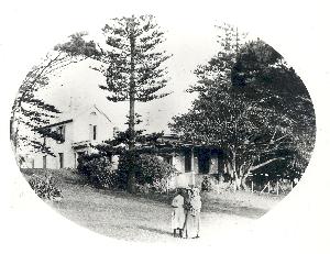
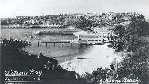
During this decade the focus of the broader Sydney establishment is drawn towards the district. Overseas events make the defence of Sydney Harbour an urgent issue; the entrepreneurial interests and initiatives of Ralph Meyer Robey and Elias Carpenter Weekes are turned towards the tourist potential and land-development possibilities of Watsons Bay, and the focus of the colony is drawn upon South Head by the Dunbar disaster and the need disclosed by the tragedy for better navigational aids and procedures. Another substantial house, Zenleith, joins Zandvliet on the Watsons Bay waterfront, built by George Bainbridge and later the home of harbour pilot Robert Cork.
The Greenwich Pier Hotel, formerly the house 'Zandoliet (centre) with the house 'Zenleith' behind c.1905
1850
- A tide surveyor is appointed as part of the Customs Office and based at Watsons Bay. A government house was provided for the surveyor in 1854, but the position was abolished in 1855.
1852
- Richard Leftwich, a Sydney shoemaker, purchases the piece of land on which he builds without delay the South Head Signal Hotel.
1853
- By 1853 the South Head Signal Hotel is operating at a site opposite the Signal Station, under the proprietorship of Richard Leftwich.
- The impending war with Russia (Crimean war, declared March 1854) leads to fresh review of Sydney’s defences and provides the impetus to act on earlier schemes advocated for the defence of the harbour. The NSW Legislative Assembly authorizes the construction of works in a number of key strategic points including Inner South Head, with provision at the latter site for emplacements for 25 guns, barrack accommodation, stores etc. Construction, by the men of the 11th Regiment, begins on 18th October.
1854
- A properly formed road replaces the rough track formerly connecting the South Head Road with Watsons Bay.
- An excursion ferry service to Watsons Bay is established by Ralph Robey and Elias Weekes operating under the business title of the Sydney and Melbourne Steam Packet Company. A wharf known as the ‘Victoria’ is built at the foot of Victoria Street within Robey and Weekes’ ‘Town of Watsons Bay’ subdivision and serviced by the company’s steamer Victoria. Another facet of their expansive plans for the area was the purchase of the marine villa Zandvliet for conversion to a hotel.
- An official ‘sub-post office’ is opened in Watsons Bay in August.
- Town of Watsons Bay subdivision(PDF, 22KB) for more information.
1855
- Work on the defences at South Head is suspended in March by the new governor, Sir William Denison. The legacy of this unfinished mid-century undertaking at South Head is the military road, marked on maps of the period as the ‘government road to the batteries,’ and an unfinished gun-pit on Inner South Head intended for a 32-pounder gun.
- An auction sale of the former Laing grant under the name of the ‘Town of Watsons Bay’ is scheduled for April, but withdrawn due to drainage problems. The land proceeds to auction later in the year, but sales are slow.
- A lifeboat shed is built at Camp Cove, although the official service does not get underway until 1858.
1857
- The ship Dunbar founders 500 metres south of the Gap on the 25 August with the loss of 121 lives – all passengers and all but one of its crew. The disaster immediately prompts an investigation into the need for further navigational aids for ships entering the port, and the event becomes the most well-known shipwreck in Sydney’s history.
- The loss of the Dunbar(PDF, 145KB)
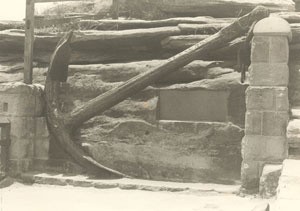
An anchor from the 'Dunbar', retrieved in 1910 and later made the centrepiece of the memorial at the Gap
Photograph Eric Russell 1979
- The Light, Pilot and Navigation Board takes evidence during September, in the wake of the Dunbardisaster, and recommends the construction of a new lighthouse on the Inner South Head. By late October the project has been costed, and the site selected [1]. The architect supervising this work was Alexander Dawson, the then Colonial Architect.
- Hornby Light(PDF, 120KB)
- With the memory of the loss of the Dunbar still fresh in colonial memory, the ship Catherine Adamson is wrecked when entering the harbour under the control of a harbour pilot on 24 October, with the loss of 21 lives. This event adds to the sense of urgency for further navigational assistance for incoming vessels.
1858
- In January, Alfred Toogood purchases the Marine Hotel, established in 1854 in the former house Zandvliet, and constructs a wharf for the convenience of patrons on the property’s water frontage. The wharf becomes a defining feature and the hotel is subsequently re-named the Greenwich Pier Hotel and is later known as the Vaucluse Pier Hotel.
- Construction work on the new Inner South Head lighthouse is completed in June and the facility named the Hornby Light, for Admiral Sir Phipps Hornby, father-in-law of then Governor, Sir William Denison.
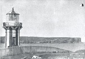
The Hornby Light, date unknown
Photograph Neville Singleton
- An official lifeboat service for the port of Sydney is established with the arrival of a specially built craft from England. The 6-pounder field gun placed near the Signal Station in 1854 as part of the response to the Crimean War (see entry under 1853) becomes the means of summoning the lifeboat crew to emergency duty.
- A stone marker is erected at the water’s edge at Laings Point as a further navigational aid defining the position of the rock shelf off Inner South Head in transit with a stone obelisk placed at this time at Parsley Bay. Both of these markers are still in place.
- The opening of the first telegraph line in New South Wales connects the Signal Station with the Royal Exchange Building in Bridge Street.
1859
- South Head School openes in the South Head Independent Chapel opposite the Lighthouse Reserve. The school moved in the second half of the following decade to a building above Gibson’s Beach, erected in 1860 as a pilots’ station.
- Alfred Toogood leases the Marine Hotel&to the entrepreneurial Henry Billings, who begins to charter ferries on holidays to lure visitors to the area. Billings also added a number of attractions to the premises including a ballroom, constructed on part of the pier, and a menagerie of animals for the interest and entertainment of hotel guests and tourists. His menagerie featured in performances which drew crowds, a newspaper account of his act noting that it concluded with Billings himself putting his head into the mouth of one of his pair of ‘magnificent’ lions and ‘and whilst it was there loosing his hold on the animal’s jaw.’ [2]
- Sydney Morning Herald, 29.10.1857, p. 4.
- Sydney Morning Herald, 2.1.1861, p. 4.
1860s
Changes to local maritime practice are introduced in the aftermath of the disasters of 1857. The newly established official lifeboat service carries out a number of rescues during this decade, and pilotage is brought under government control – an arrangement which eventually lapses.
1860
- Competitive pilotage is suspended as part of the official response to the Dunbar investigations and a government scheme introduced. Land above Gibson’s Beach is purchased by the crown and a pilot station built to provide on-shore accommodation for pilots and their crew. When government pilotage falls into abeyance, the pilot building is used to house firstly the Watsons Bay National School, and later the Watsons Bay police service. The original building is replaced by a new Police Station in 1928.
- Daniel Egan, MLA purchases land and an iron house at the Gap – possibly the house previously provided for the government tide surveyor – and establishes the Gap Hotel, later to become the headquarters of the newly incorporated Council of Vaucluse.
- Woollahra Council is incorporated, the South Head district falling within its boundaries and remaining part of this administration until 1895. The Council was proclaimed in mid April and met for the first time in early June.
1862
- Construction of St Peter’s Church, designed by Edmund Blacket, begins after a protracted fundraising process. Land had been appropriated for the building in the 1850s with the help of Henry Watson Parker, Premier and owner of Clovelly.
1864
- Construction of St Peters Church is completed and the church consecrated, 27 December 1864.
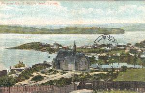
Postcard view of St Peters Anglican Church with Camp Cove in the near background early 20th century
- Mathew Silva, a Portuguese immigrant, is operating what is believed to be the first grocery store in Watsons Bay at his house at 1 Cove Street.
1867
- The sum of £70 is voted at a meeting of Woollahra Council for the sinking of a well and erection of a public pump at Watsons Bay.
1868
- Land on Marine Parade is transferred to William Harmer, a Sydney builder, and the house Mandalay is then built (address today is 11 Cliff Street).
1870s
The community of the region continues to develop along maritime, tourist and military lines. Carvings visible in the sandstone rock face at Cliff Street are believed to date from this period, the work of the ‘butcher boat’ crews as they waited near the Camp Cove wharf to row out to meet incoming vessels. The butcher boats, which took orders on behalf of the local provedores, were yet another facet of the maritime history of Watsons Bay.
1870
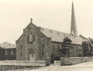
- The first Catholic Church in the district, hand-hewn from its site by a team headed by Joseph Silva, is sufficiently complete to be used for regular mass. The church is variously known as St James, St Francis and St Anthony’s. This church is now the church hall at Vaughan Village, Old South Head Road.
- A Defence Committee devises a scheme of ‘inner’ and ‘outer’ lines of harbour defences, including two batteries at Inner South Head in the outer line of defence. Fortification of Steele Point (in present day Nielsen Park, Vaucluse) also dates from this period of fortification. A casemate at Camp Cove is proposed but never built.
1871
- Tenders for the batteries at South Head are accepted in January and construction takes place over the ensuing four years under the supervision of colonial architect James Barnet.
1874
- Guns are placed on South Head as a deterrent to foreign attacks. The South Head fortifications by this year include three ten-inch 18 ton RML; two nine inch 12 ton RML and five 80-pounder (converted) RML. The nine-inch RML Mark V gun (on carriage) now standing at the northern end of Camp Cove as a ‘mascot’ dates from this period, having been moved to its present location in recent times from the Hornby Battery on Inner South Head.
1875
- The pilot system is again brought under government control and a new steamer, the Captain Cook, built for use as a pilot ship, berthed at a buoy moored off Camp Cove.
1876
- Harmer’s Ferries, run by William Harmer, establishes a regular ‘commuter’ service to Watsons Bay.
- The Council of Education agrees to establish a new public school at Watsons Bay, the enrolment of the independent but subsidised South Head School having reached 70 pupils during the 1870s.
1877
- Colonial Architect James Barnet recommends replacement of the Macquarie Light-tower when an inspection of the structure reveals decay and deficiencies. The replacement tower is also planned to accommodate a larger lantern than the original.
- Macquarie Light-tower(PDF, 134KB) for more information.
- The foundation stone is laid in January of a new public school and headmaster’s residence at a site on Old South Head Road, construction proceeding to plans drawn by government architect George Allen Mansfield. The new school is opened in September. Both buildings still stand at 333-335 Old South Head Road.
Former headmaster's residence, 333 Old South Head Road, c.1970s
- Accommodation buildings constructed on Inner South Head for members of the NSW Artillery are completed and handed over. These buildings remain within HMAS Watson.
1878
- A torpedo observing and firing station is built at Green (Laings) Point during this year, part of the harbour defences based at Chowder Bay.
1880s
Tourist facilities are increased – both through private and government initiatives to make the area more attractive. The evolving fortifications become an added interest for sightseers.
1880
- In March, Sir Henry Parkes lays the foundation stone of the new lighthouse construction of which had begun the previous year. The new structure, built beside the original, was designed by Barnet to closely resemble Greenway’s light-tower while nevertheless incorporating some improvements and technical advancements.
- At the conclusion of Australia's first international exhibition in April, the new port lifeboat later to be named the Lady Carrington, is commissioned for service and based at Watsons Bay. The English-built boat had featured among the exhibits of scientific and industrial advancements from around the world on display in the Garden Palace in the Domain between 17 September 1879 and 20 April 1880.
- The ‘Alice Rawson’ and the Port Jackson lifeboat service(PDF, 37KB) for more information.
- The colonial government erects a new wharf at the foot of present-day Military Road, in the location of the present wharf.
- Tourists are given a new reason to visit the Bay with the establishment of The Caves, a resting place for ‘day-trippers’ created from a rocky site on the eastern side of Russell Street. An overhanging rock canopy provided shade and gave the venue its name, the natural canopy augmented by a canvas awning, and the rock floor boarded over as a base for seating. Refreshments were served from an adjacent weatherboard building.
- Over the ensuing decade, 6 inch breech loaders were installed in the South Head gun emplacements in response to the increased firing capability of naval vessels.
1881
- The Portuguese-built St Anthony’s Catholic Church in Old South Head Road is officially dedicated.
- A Marine Biological Station is built at Camp Cove for Russian scientist Nikolai Nikolaevich Miklouho-Maclay. Maclay married the daughter of Sir John Robertson, the last owner of marine villa Clovelly and five times Premier of New South Wales. After a lengthy period in military ownership this building was transferred to the Sydney Harbour Federation Trust in 2001, and still stands at 31 Pacific Street.
- A public wharf is built at the foot of Bay Street (now Military Road), later replaced in 1910.
1883
- The new Macquarie Lighthouse becomes operational and the original light-tower is decommissioned.
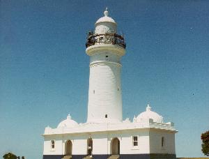
Macquarie Lighthouse c.1980
1885
- Henry Newton and his wife Hannah open a small tea-room on Marine Parade, Watsons Bay - the forerunner of their grand-daughter Alice’s restaurant Doyles, which today occupies the same site as these tea-rooms.
- Military authorities plan the establishment of a torpedo station at Camp Cove.
- Military authorities acquire the recently established Marine Biological Station of Russian scientist Nikolai Nikolaevich Miklouho-Maclay as urgently needed accommodation for military personnel. Known from that time as the ‘Green Point Quarters’, the building later served as married quarters for army officers.
- An early swimming facility is created when the so-called ‘Bogey-Hole’ is rough-hewn from the rocks off Green (Laings) Point by two local men, Jack Graham and Reg Newton in the late 1880s. The swimming hole is still visible today.
1886
- The Palace Hotel, believed to have been designed by the architect John Kirkpatrick, is built. The first proprietor of the hotel was Thomas Strange, formerly of the Greenwich Pier Hotel (now Dunbar House).
1887
- The original Greenway light-tower is demolished, a retaining wall at the site being the only remnant of the 1816 building.
- The subdivision and sale of land surrounding the Gap Hotel provides the impetus for the development of a small commercial centre along Military Road, Watsons Bay. From 1895 until its transfer to present-day Dunbar House in 1924, the Vaucluse Council had headquarters within this commercial ‘strip’, operating first out of the former Gap Hotel and later from a purpose-built chambers on the same site.
1888
- William Johnston establishes the grocery store known as The Gap Stores from premises leased from Sir John Robertson on Military Road between Bay and Toogood Streets.
1889
- In November, the post office moves briefly to a weatherboard cottage in Cliff Street, under the charge of Charles Manuel.
1890s
The establishment of a new local government area, with an administration based at Watsons Bay, is one demonstration of a number during this decade of the increased population and growing economy of the district.
1890
- The post office is installed in a property leased from Edward Edwards in what is now Military Road (then known as Bay Street), opening there in December 1890 and remaining until 1908.
1891
- A second Congregational church for the district is built in Watsons Bay on the Gap Hotel subdivision. Constructed of corrugated iron, with Gothic windows, this Mission Hall is colloquially known as the ‘Tin Tabernacle’. Use of the older, South Head Independent Chapel at first overlaps with worship in the new building, the old stone church used for morning worship and the new iron church for evening services. However, use of the stone church gradually declines from this point until it falls into disuse and is demolished by a storm in 1910. The Tin Tabernacle was demolished in the 1930s, local Congregational worship having moved to Vaucluse in 1909 when a new church was built in Russell Street.
- The Grand Pacific Hotel replaces the old Signal Hotel, built by the then owner of the Signal Hotel, John Hinchcliff at a site slightly to the north of the earlier building. This hotel was demolished during the 1930s.
Old South Head Road with the Signal Station (right) and the South Head Independent Chapel, South Head Family Hotel and the Grand Pacific Hotel (left), c.1894
1893
- A new pilot ship, named the Captain Cook after the first pilot steamer, replaces the 1875 original and is berthed at new moorings laid in Watsons Bay.
- A breach-loading hydro-pneumatic 9.2inch gun is placed at Signal Hill, Outer South Head - one of three commissioned for points along the Sydney coastline (others located in the Bondi and Clovelly districts). The 9.2 inch was the largest bore gun installed in the South Head area. Mounted in a pit, the gun disappeared on recoil and was driven back into firing position by hydraulic power. This gun was removed in 1937.
- William Johnston moves his grocery store to new premises he built at 25 Military Road.
1894
- A successful petition is submitted to the colonial government in August bearing the signatures of residents of the Vaucluse, South Head, Watsons Bay and Camp Cove areas and praying for the subdivision of the Municipality of Woollahra to form a new municipal district.
1895
- The borough of Vaucluse is proclaimed in May, bringing the South Head, Watsons Bay and Camp Cove localities under the new civic administration of Vaucluse. The council sets up offices in the former Gap Hotel in Military Road Watsons Bay, the site with which the Council will be associated for the ensuing twenty-nine years, occupying firstly this building and from 1909 a purpose-built chambers which replaced it.
- The School of Gunnery is transferred in July from Middle Head to South Head and new quarters and training facilities provided on Gap Bluff.
- Married quarters for Artillery personnel are built on the site of the former Water Police Station (No 32 Cliff Street) between 1895 and 1903. Today known as the Constable’s Cottage.
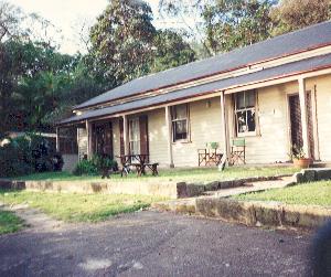
The Constable's Cottage, c.1996
- Among its earliest initiatives, Vaucluse Council expends funds to enlarge the Bogey-Hole for the enjoyment of swimmers.
1897
- The Watsons Bay property rented by Vaucluse Council as council chambers is purchased outright by the Council in June and eventually becomes the site of the Vaucluse Town Hall.
1900s
The turn of the century heralds vast improvements to the public transport serving the district, an essential precursor to the suburban development of the adjoining suburb of Vaucluse, and to the viability of the new borough supporting the South Head district.
1900
- Caesar Anthony Colonna installs a camera obscura as a tourist attraction at Gap Park. The instruments are viewed with suspicion by the local military authorities, who believed the building ‘might afford an opportunity for foreign spies to study the fortifications at South Head’.
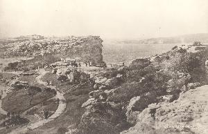
Postcard of Gap Park showing the building housing the 'camera obscura' (centre), c.1900
- A memorial is unveiled in December in memory of Lieutenant Gideon James Grieve, a local resident who fell at Paardenberg South Africa on 18 February, 1900. The design originally included a drinking fountain and featured a highland figure in reference to the man it honoured, who was a Lieutenant in the Black Watch. This memorial stands on the southern edge of Gap Park.
1901
- The Minister for Works in September turns the first sod of the extension of the New South Head Road tramway from the city to South Head. This project saw the tram terminus moved from the Dover Road intersection, Rose Bay to the Signal Station in 1903, and ultimately to Watsons Bay in 1909.
1903
- Construction of the tramway extension to South Head is completed on 14 April and the line opened to passengers on 11 May.
- Demolition of Clovelly, which had become derelict after Sir John Robertson's death in 1891.
- Clovelly(PDF, 293KB)
Julia, Kate and Juluia Rose Jacinto in front of 'Clovelly', c.1870
Private collection.
1904
- Vaucluse Council decides to build a public bathing facility and in August enters into negotiations with the Harbour Trust regarding the selection and lease of a site. The preferred site (at the foot of present day Robertson Place) is secured in December, by which time plans have been drawn by Messrs A S & G McCredie and the tender of Alfred Whitton (for £1,625) accepted.
- Michele Marinato establishes a shop at Watsons Bay, initially in a former waiting-shed leased from the Sydney Harbour Trust but moving soon after to a purpose-built structure on the Watsons Bay wharf. The business gave service to ferry travellers, local residents and often visiting dignitaries. This shop became a local institution, operating through three generations of the Marinato family, and from a succession of wharf-based premises, until 1968.
1905
- By May, construction of the Watsons Bay baths, built of timber and iron, is complete and the lease to the first proprietor, Mr Benjamin Young, established.
The Watsons Bay Baths, c.1910
Photograph Graeme Andrews
1906
- An area of land immediately opposite the baths is gazetted in May as a public reserve to complement the new public swimming facility. Part of the Humphreys family’s 4-acre grant, this land would later become the site of dressing accommodation for bathers.
- Clovelly,the estate of the late Sir John Robertson, is resumed for public recreation. Initially known as Clovelly Park, the land now forms part of present-day Robertson Park the site increased in size with additional resumptions between 1909 and 1912. The name eventually adopted commemorates the final owner of this marine villa.
- Robertson Park(PDF, 97KB) for more information.
1907
- The Alice Rawson(PDF, 37KB) , a new life-boat for the port of Sydney, is launched in August at Cockatoo Island Government Dockyard to replace the Lady Carrington. Named for the late wife of NSW Governor Sir Harry Holdsworth Rawson, the boat was launched by his daughter, after which, loaded with cadets from the naval training vessel the Sobraon, the 38-foot craft was deliberately overturned using a crane to demonstrate her self-righting capabilities. The lifeboat was from then stationed at Watsons Bay in a shed with slips on the Gibsons Beach waterfront, purpose-built for her in 1907. For the ensuing 40 years, the Alice Rawson became part of the local maritime culture.
- A convent school opens near St Anthony’s Catholic Church.
1908
- Vaucluse Council resolves to have plans drawn up for a Town Hall and offices. This work is undertaken by architect Varney Parkes.
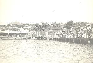
- The Ozone Café is built by Henry Newton and Eva (nee Newton) and Charles Everitt (parents of Alice Doyle, nee Everitt) on the site of the Newton’s tea-rooms which had been demolished the year before. This is today the site of Doyle’s on the Beach.
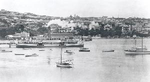
Postcard view of the Watsons Bay foreshores showing the Ozone Cafe (left), the Marinato's shop on the wharf (centre) and the ferry waiting room (right), date unknown
The Rose Series
- The post office is moved to a site on the corner of Clovelly Street and Military Road, centrally placed amidst what would become the modest shopping centre for the Bay.
- The visit of sixteen American warships – The Great White Fleet – on their tour of the world is a major event in Sydney, with streets and buildings decorated, processions staged, souvenirs produced and lavish entertainments arranged by the hosts for the visitors. The arrival of the fleet draws an estimated crowd of 80,000 to the South Head to witness the spectacle.
1909
- The tramway is extended to Watsons Bay, the new section of line completed in January. The line eventually becomes the most popular and well-used tram route in the Sydney system.
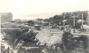
Postcard view of the tram at Gap Park , c.1909
- The tender of Messrs Peacock & Stephens for the building of the Vaucluse Town Hall is accepted, and construction work begins.
- The new Town Hall is officially opened by the NSW Minister for Works in April. This building still stands in Military Road, Watsons Bay.
- The foundation stone of a new Catholic Church in Old South Head Road is laid near St Anthony’s.
1910s
1910
- Vaucluse Council joins forces with the Watsons Bay and South Shore Steam Ferry Company to publish the Tourists’ guide to Watsons Bay and Vaucluse, designed to promote the district as both a growing residential area (Vaucluse) and a tourist destination (Watsons Bay).
Ferry at Watsons Bay Wharf, date unknown
The Rose Series
- Anchors of the ship Dunbar(PDF, 145KB) are recovered from the sea near Jacobs Ladder and one placed at the mass gravesite of victims in Camperdown and the second put on display with other relics of the shipwreck in a museum located behind the Vaucluse Town Hall in Military Road. The anchor is later incorporated into a memorial to the ship erected at the Gap in 1930.
- The new Catholic Church is opened for worship as Our Lady Star of the Sea on 10 June.
Our Lady, Star of the Sea Catholic Church, 1979
Photograph Eric Russell
- The first church in the district, the Independent South Head Chapel, is destroyed during a wild storm in July.
- The upper floor of the Town Hall is licensed to Arthur Tiley for the purpose of ‘conducting moving pictures’ in September[1]. The cinema was known as the Rivoli Picture Theatre and later the Watsons Bay Theatre. It is believed that an open air cinema was operated prior to this by Arthur Tilely in the grounds of what is now Dunbar House. Tiley maintained his license to show pictures at the Town Hall until the mid 1920s.
- The consecration and dedication of Lodge Vaucluse takes place on 16 April. The trustees of Lodge Vaucluse decide that the Town Hall is not a suitable meeting place as had been first thought and purchase the Congregational Mission Hall in Military Road for this purpose.
1911
- First meeting of Lodge Vaucluse is held at the Congregational Mission Hall.
- Additions to the Palace Hotel approved by Vaucluse Council, designed by architect F. Moorhouse.
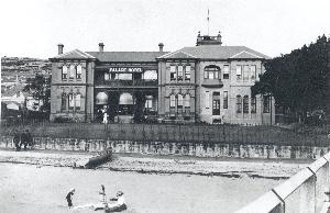
The Palace Hotel at Watsons Bay, c.1912
1914
- After appeals from the Eastern Suburbs United Band, Vaucluse Council agrees to erect a bandstand in Robertson Park suitable for performances. An octagonal wooden structure with a shingled roof is constructed on a concrete base and readied for use by November, when a program of Sunday evening concerts was introduced.
- The outbreak of hostilities saw the manning of local coastal defences reduced, as the need to deploy troops elsewhere is recognised.
- In October Vaucluse Council enters into an agreement with the City Council which allows for the extension of mains and cables for the supply of electricity to the municipality
1915
- Plans for a new fire station at 216 Old South Head Road, the site of the former South Head Independent Chapel, are approved in April. Designed by architects Spain & Cosh.
1918
- The main sewer and outfall is completed, along with a Watsons Bay branch sewer which extends to Cliff Street. Reticulated sewerage is not available to all householders within the Municipality of Vaucluse until 1937.
1920s
A number of locally important capital works are undertaken during the ensuing decade, in an atmosphere of post-war confidence.
1920
- Sydney Ferries takes over the ferry service previously operated by the Watsons Bay and South Shore Ferry Company, purchasing the steamers and wharf leases in June and adding, through consolidation of two existing routes, the Nielsen Park stop to the Watsons Bay run.
1922
1923
- Vaucluse Council takes the decision in October to demolish the 1905 baths, now in a dangerous state of disrepair that had attracted the attention of the Harbour Trust. The decision provokes a community outcry. Residents are assured by Council in November of its intention to ‘provide fresh bathing facilities’ in Watsons Bay.
1924
- A Council sub-committee is formed to consider the question of replacing the bathing enclosure in April, and a contract entered into with C R McKenzie in May. Construction of the new baths is underway by October.
- The Vaucluse Council establishes a new council chambers in the former marine villa Zandvliet, operating as the Royal Hotel immediately prior to Council’s purchase. The new chamber is officially opened as such in November 1924. Later, in Woollahra Council ownership, the property is re-named Dunbar House.
- The trustees of Lodge Vaucluse purchase the old Vaucluse Town Hall at auction in September with plans to convert it into a Lodge room. They decide instead to build a new Masonic Temple on land at the rear of the Town Hall and to renovate the Town Hall for continuing use as a picture theatre.
1925
- Structural failure becomes apparent in the still incomplete new bathing enclosure with the collapse of the western end of the construction in October. This begins a protracted period of legal argument.
- Watsons Bay School moves to newly built premises on land purchased from Wentworth’s Vaucluse Estate, between Cambridge Avenue and Village High Road. The name changes to Vaucluse Public School.
1926
- In December, Council selects the land opposite the baths, gazetted for public use in 1906, as the site of a dressing pavilion.
- The last meeting of Lodge Vaucluse is held at the Congregational Mission Hall in February. The new Masonic Temple at 8 Gap Road, completed to the design of the architect Oscar Beattie, is consecrated in May.
1927
- In January a monument and plaque is erected by the Royal Australian Historical Society and Vaucluse Council claiming Camp Cove as the first landing place of the European settlers in Port Jackson. A commemoration held at the site marks this sesquicentenary of the events of January 1788.
- Council accepts, in May, the offer of Alderman Hurst to act as honorary architect for the building of the dressing sheds on the Watsons Bay waterfront. Hurst’s plans are presented to council in September and authority to call tenders granted.
- The new Watsons Bay baths are completed in June, under a new contract to a new construction company – Julius, Poole & Gibson.
- The collision between the RMS Tahiti and the Watsons Bay ferry Greycliffe on 3 November devastates the local community with the deaths of a large number of commuting school children from the district. The incident remains the worst accident on Sydney Harbour, with the overall loss of 39 lives.
1928
- Construction of the dressing shed building to serve the new Watsons Bay baths is complete by May and leased to the lessee of the baths. The building had cost over £2,000. The following year the journal Building reviewed the structure, commenting that the provision of this facility confirmed the area’s growing popularity.[1]
- The Vaucluse Police Station is purpose built at 178 Hopetoun Avenue overlooking Gibsons Beach, on the site of the first pilot station.
1929
- Robert Watson monument – an inscribed stone seat – is erected on the waterfront at Watsons Bay, near the ferry wharf, in honour of the early nineteenth century seaman who had given his name to of the locality. The monument was installed by Vaucluse Council at the suggestion of the Royal Australian Historical Society and was designed by distinguished local architect Leslie Wilkinson.
- Greycliffe Memorial Gates are installed at the entrance to St Peter’s Church of England and dedicated as a memorial to the victims of the Greycliffe ferry disaster of 1927.
- Use of the former Watsons Bay school building is taken over by the Boy Scouts and Girl Guides movement. Renamed& The Gunyah, it is officially opened as the new scout's headquarters on 20 July.

The Gunyah, Old South Head Road, 1996
- Gray, William, ‘Pictures at Watsons Bay, Sydney, NSW: a village within an historic village’ in Kino Cinema Quarterly, No.90, 2004, p.37.
- Building 12.1.1929 p.91
1930s
The effects of the Great Depression of the early 1930s are felt in the local community. Businesses are forced to adapt.
1930
1932
- First indication of the additional use of the Watsons Bay dressing shed building for food service, with the appearance in the issue of the Sands Directory for that year of Mr Henry Atkinson, lessee of the baths, as the proprietor of a refreshment rooms on Marine Parade, consistent with the situation of the dressing sheds. The building later becomes known as The Tea-Rooms.
1933
- On 31 July, the regular Watsons Bay commuter ferry service provided by Sydney Ferries ceases operation, an unlikely victim of the opening of the Sydney Harbour Bridge in March 1932. This event had dealt such a devastating blow to Sydney Ferries through lost patronage on its north-shore runs that the company’s smaller services – including the Watsons Bay run - were sacrificed in an attempt to salvage business elsewhere on the harbour.
- The Ozone Café is forced to close due to the effects of the Great Depression. Structure is converted into flats by Charles Everitt, one of which housed the family of his daughter Alice before the end of the decade.
1937
- The Palace Hotel is demolished to make way for the Watsons Bay Hotel, designed by architects Scott, Green and Scott.
- The Officers’ Mess building is completed at the School of Artillery on Gap Bluff.
1938
- The 150th anniversary of the first landing in the harbour is marked at Camp Cove by 3,000 people attending a commemorative function organized by the Royal Australian Historical Society.
1939
- The third pilot ship is put into service, taking the name Captain Cook from its two predecessors.
- Guns at South Head and Signal Hill are upgraded in the early war years as part of the Australian coastal defence network.
- The Vaucluse Yacht Club moves to its new headquarters on the Watsons Bay waterfront on Marine Parade, the site still occupied by the club today. The new clubhouse is officially opened on 28 October, 1939 by Sir Eric Harrison. Founded in 1932 as a splinter group of the Vaucluse Amateur 12 Foot Club, the Vaucluse Yacht Club came into being as the result of the development of the Vee-Jay (Vaucluse Junior) – a new class of boat specifically aimed at the young novice sailor.
1940s
The military character of the area is intensified during the war years. The wharf at Watsons Bay is extended to accommodate warships in increasing number. On Green (Laings) Point, an anti-motor torpedo boat section is built midway through the war, comprised of a reinforced concrete tower and having a gun-floor with 6-pounder twin quick-firer gun having a magazine below and observation post and searchlight-directing levels above. The building stood to the north-west side of Green Point, almost at water-level and was demolished after the war. This replaced the two 3-pounder quick-firer guns previously in situ.
The extended wharf, during World War II
Private collection
1942
- An anti-submarine boom net designed to protect Sydney Harbour from attack is under construction when three Japanese midget submarines enter the harbour on the night of 31 May-1 June. While the net was dismantled and all associated structures demolished after the war, the remains of the foundations of the winch house are still visible on Laings Point. In October 1995 a plaque was installed by the Woollahra History and Heritage Society to mark the historical significance of these remains.
1945
- The portion of the School of Artillery at Gap Bluff, occupied during the war years by a naval radar communications centre, is commissioned as HMAS Watson.
1946
- Vaucluse Council establishes a Children’s Library at Watsons Bay on the ground floor of Dunbar House, the facility opening in July. The collection was based on the purchase of the book stock of the Honey Bee Children’s Book Club in Girilang Avenue Vaucluse. This 1946 initiative was the first council-operated library in the area that is today covered by the administration of Woollahra, opening almost a decade earlier than the Woollahra Library service in Double Bay.
- The need for a lifeboat service is reviewed, and the decision taken to place this responsibility with the better-equipped pilot service. This led to the decommissioning of the port’s lifeboat, the Alice Rawson, based since 1907 on the Watsons Bay waterfront – the last in a series of lifeboats which had served the port of Sydney.
- The ‘Alice Rawson’ and the Port Jackson lifeboat service(PDF, 37KB)
1948
- Alice Doyle, with the support f her husband Jack, re-opens the Ozone Café serving fish, followed by scones and jam for dessert. The revived café is later re-named Doyle’s,eventually becoming Doyle’s on the Beach to distinguish it from later established branches of the family’s restaurant group.
- The Municipality of Vaucluse is amalgamated with neighbouring Woollahra under the Local Government (Areas) Act, 1948. Vaucluse Council meets for the last time in December.
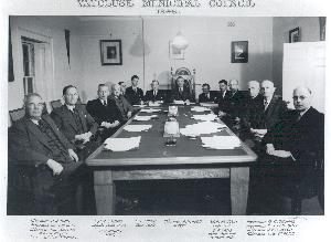
Meeting of the final council of the Municipality of Vaucluse, 1948
1950s
The postwar era brings change to the Watsons Bay waterfront.
1950
- Woollahra Council votes in February to re-name the former Vaucluse Council Chambers, now part of Woollahra’s assets, as Dunbar House to mark the significance of the 1857 shipwreck to the history of the area.
1958
- The shed which had formerly housed the lifeboat Alice Rawson prior to her decommissioning in 1947 is demolished, destroying the last local link with the service established a century earlier.
1959
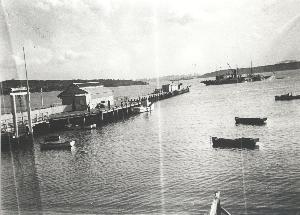
- The pilot steamer Captain Cook and associated ‘boarding boats’ are replaced by three smaller diesel-powered vessels. A jetty and pilot’s station are constructed at Gibson’s Beach, Watsons Bay to supply the accommodation need previously met by the pilot steamer. The new, two-storey station occupies the site of the boatshed used for the former Watsons Bay lifeboat Alice Rawson,and stands close to the site of the original pilot’s station, built almost a century earlier.
- Screenings cease at the Watsons Bay Theatre, known variously since 1924 as the Rivoli, Rex, New Rex and Village Theatre.
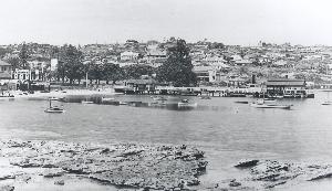
Postcard view of Watsons Bay showing the 1959 pilot station (foreground) and the baths and yacht club (centre)
1960s
The social changes of this decade and its successor are manifested locally, with the use of Lady Jane Beach as a nudist swimming and sunbathing area gaining popularity among Sydneysiders.
1960
- The last tram runs on the Watsons Bay line in the early hours of the morning, 10th July as the service is replaced with buses.
- During the 1960s the portion of South Head occupied by the navy expands into adjoining military lands as the naval facilities and services concentrated in the area increase.
- Guns are removed from the South Head installations, putting an end to the lengthy era of the fixed-defence of Sydney. Evidence of the emplacements is still evident along the Cliff Walk, and a 9 inch RML dating from the 1870s remains just north of Camp Cove.
1961
- The military Chapel of St George the Martyr is built within the HMAS Watson site as a memorial to men and women of the Royal Australian navy who had lost their lives in World Wars I and II and the Korean War.
1964
- Construction work to expand the Watsons Bay baths and create an area suitable for competition is completed in time for the swimming season.
1968
- The Marinato family, three generations of which had served the Watsons Bay public from their various wharf-based premises, sells the business to the Doyle family. Under Doyle management the business becomes Doyles on the Wharf as part of their restaurant group.
1970s
1975
- Problems arising from the use of Lady Jane Beach (now known as Lady Bay) for nude sunbathing leads to local petitions and deputations, and a statement publicly denouncing the practice from the MLA for Vaucluse, Keith Doyle.
1976
- An investigating panel of the (Liberal) NSW government decides in March against setting aside a Sydney beach for legal nude sunbathing/swimming. Lady Jane at Watsons Bay had been widely expected to be nominated as the beach where nude bathing would be permissible, due to its seclusion and the established custom of nude swimming at this location.
- The Premier of the newly elected (May) state Labor government Neville Wran, declares on 18th October that Lady Jane and Reef Beaches would be subject to a trial period of nude bathing for the coming summer months. Despite various outbreaks of criticism at intervals over the 1980s and 1990s, nude bathing has remained a tradition at Lady Bay.
1978
- Acquisition of surplus army land at South Head leads to the demolition of the old barrack blocks overlooking Camp Cove.
1980s
This decade increases the district’s credentials as a tourist destination and place of leisure while the links to its earliest reasons for existence – strategic, navigational, military and maritime are weakened.
1982
- The Marine Parade premises of Doyle’s on the Beach are re-built in a style to reflect the restaurant building’s turn-of-the-century origins as the Ozone Cafe.
- Portions of the former defence reserve are dedicated as part of the Sydney Harbour National Park, creating a new area for public enjoyment along the coastal strip between Camp Cove and the Hornby Lighthouse, and on Gap Bluff. This acquisition led to the demolition of most of the School of Gunnery and World War II radar building.
- Closure of the Catholic School due to declining enrolments leaves the site available for reuse as an aged care facility.
1983
- Signal Hill Reserve, the site of the Look Out Post and subsequent Signal Station, is gazetted for public recreation in September.
1986
- After some years of planning and construction the aged care facility, named Vaughan Village for Archbishop Vaughan who administered to the parish in 1880, is ready for occupation by October. The replacement of the former school with accommodation for older people is clear indication of the changing demographics in the area.
1988
- The Bicentenary of European settlement is celebrated throughout the year and includes events reflecting the historical significance of the South Head district in the context of this milestone. Woollahra History and Heritage Society marks the 200th anniversary of the first landing in the harbour at Camp Cove on January 21, and local community events co-coordinated by the Woollahra Bicentennial Community Committee include festivities in Robertson Park, a children’s treasure hunt on the Watsons Bay beachfront and a regatta. Woollahra Council, assisted by funds from the Australian Bicentenary Authority, creates a Bicentennial Cliff Walk between the Signal Station and Christison Park.
- Despite two years of resident action the Watsons Bay post office is closed and the premises sold by October.
1989
- The Macquarie Lighthouse is de-staffed, ending a tradition dating back to the appointment of Robert Watson in 1818.
1990s
The character of the Watsons Bay area continues to evolve. Operational changes to long-standing government facilities, such as the Lighthouses and Signal Station, are part of the shifting focus. A community struggle to preserve within the public domain the open space associated with the now unmanned Macquarie Lighthouse is ignited by government ‘sell-off’ plans. The protest is carried across a number of years of this decade, with sale plans resurfacing at intervals. The former head lighthouse keeper's cottage and the assistant lighthouse keepers’ quarters on the site are offered on long-term (125 year) leases.
Gentrification of the housing stock sees the replacement of some 19th century timber cottages with larger residences. The Watsons Bay Heritage Conservation area is established in response to official recognition of the need to preserve the heritage of the area.
1990
- The Gap Bluff walking track is opened, traversing land previously held for defence purposes.
- A commemoration of the 200th anniversary of the first use of the signal flag at the Look Out Post is held at the Signal Station and attended by His Excellency Rear Admiral Sir David Martin, Governor of New South Wales.
1991
- The decision is made to close Vaucluse Police Station and to sell the site, initially with a lease-back arrangement allowing a police presence until 1995.
1992
- The Maritime Services Board removes their remaining operations from the South Head Signal Station and the facility is taken over in March by the Australian Volunteer Coastguard, operating the station for the benefit of small boats and leisure craft.
- In 1992 a plaque is installed by the Woollahra History and Heritage Society to correct two common misunderstandings about the 1857 wreck of the Dunbar : that she was subject to a North East gale (rather than a South East gale, as was the case) and that she foundered at the Gap, rather than at a point some 500 metres further south. The location of the 1992 plaque fixes the position of the wreck, highlighting a hand-cut marker in the rock-face above the point of impact, believed to have been originally carved soon after the disaster.
1993
- On 15 January the Woollahra History and Heritage Society commemorates the 200th arrival of the arrival of the Bellona and the first use in New South Wales of a lighted navigational aid, replicating the effect with a bonfire in a disused gun-pit near the Signal Station. The event is attended by descendents of those who arrived in the Bellona[1]. This is one of an ongoing series of commemorations hosted by the Society to mark the 200th anniversaries of the arrivals of significant vessels to the port of Sydney.
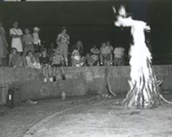
'A large fire for the information of the stranger was made at the South Head' (Captain David Collins). Youthful descendents of those who arrived aboard 'the stranger' - the transport Bellona - attend a bicentennial re-enactment on January 15, 1993.
- A bronze plaque is unveiled at Signal Hill Reserve to commemorate the historical significance of the Look Out Post and Signal Station.
1996
- Continuing public access to land associated with the Macquarie Lighthouse is finally secured in July, with a ministerial undertaking, following some years of community protest.
2000s
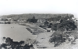
2001
- The Sydney Harbour Federation Trust Act 2001 is passed by Federal Parliament in March, its role to consider and manage the future use of various defence and other Commonwealth lands. Two important properties in the South Head district fall within this category: the Macquarie Lighthouse and the former Marine Biological Station at Camp Cove. In the process a new park is provided creating additional access to Camp Cove Beach.
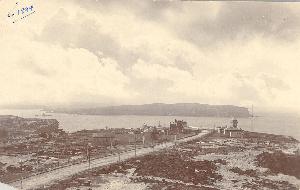
Camp Cove Beach looking towards the former Marine Biological Station, 1996.
2006
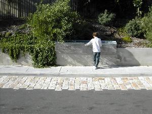
- Woollahra Council undertakes considerable remedial drainage work to correct the long-standing problem of flooding in the Camp Cove vicinity. A section of Cliff Street is lowered approximately 900mm at the beach end, allowing overland storm-water to escape. A previous road base is unearthed in the process of the works. Part of the original sandstone block base is re-laid in the new road.
2008
- After renovations, the former Marine Biological Station is made available to the public by an ‘open day’ arrangement.
- A commemorative plaque featuring a timeline is installed by Woollahra Council at Cliff Street to record the history of the Camp Cove area.
Camp Cove Time Line Plaque 2008
- Poland, Peter “Bicentennial of the arrival of the Bellona and the first recorded use of light as a navigational aid” WHHS Briefs, No 57, Syd., WHHS, 1993.